Mount Mansfield: The bitter Chin
Long Trail South to Chin
Difficulty: Hard Distance: 4.9 Miles Elevation: 4393’ Elevation Gain: 2769' Prominence: 3632’ Mountain Range: The Green Mountains
Mount Mansfield is Vermont's tallest peak at 4393' and is a moderate hike gaining more difficulty and some scrambling at certain parts.
After leaving the parking area of Stowe mountain resort head south on the long trail for a 2.5 mile hike to the summit of Mount Mansfield
 |
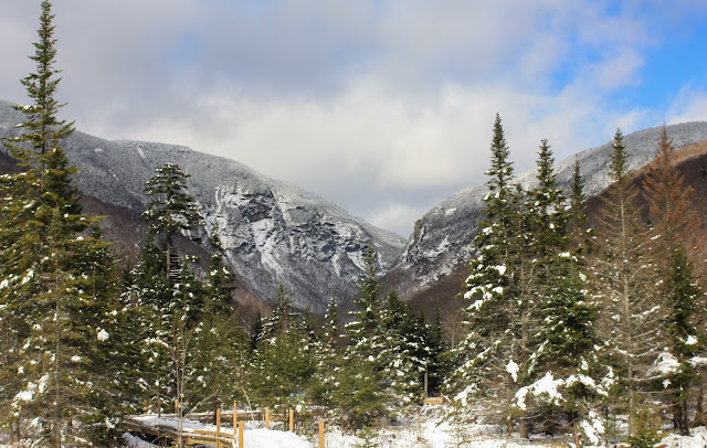
| This view is accessible by entering the Long Trail from the Stowe mountain resort parking lot |
How the photo was taken
F-stop: f/8
Exposure Time: 1/200 sec
ISO Speed: ISO-100
Focal Length: 35mm
Color Profile: Adobe Landscape
History written by Chris Hanna
The name comes from the dissolved town of Mansfield, Vermont, in which the mountain was located. It was common for settlers to name Vermont towns for their previous homes; several of the original grantees were from Mansfield, Connecticut, which in turn is known to have been named for Moses Mansfield, one of the chief landowners there. The Town of Mansfield was platted before anyone involved had visited the site; when it was surveyed, it was discovered to be mostly mountainside. Although a few hardy pioneers settled in the town's few lowlands, the town was dissolved by degrees, with the portion generally west of the mountain being annexed to Underhill in 1839, the eastern portion to Stowe in 1848 after a vote of the citizenry. The dividing line did not run exactly along the ridge of the mountain; thus, the Chin is in Underhill and the Nose in Stowe
 |
| View from the Chin, climbed via the long trail. The most prominent peak in the background is Camels Hump. |
How the photo was taken
F-stop: f/10
Exposure Time: 1/250 sec
ISO Speed: ISO-100
Focal Length: 35mm
Color Profile: Adobe Landscape
Tips: Any winter ascent from the smugglers notch side will require some form of additional traction. Whether Yaktrax, MICROspikes, or crampons are your style, some form of extra support should be required. There will be an opportunity for a bad weather bypass on the Long trail heading south which avoids some fairly steep rock faces.
Hagerman, chap. 4; Chris Hanna, Mansfield: A town divided. Accessed 2009.09.21.
“Mansfield: A Town Divided.” Mansfield: A Town Divided (1/00), nature.thecompass.com/gmcburlington/news/0001mansfield.html.

Comments
Post a Comment